Rainbow Ridge And Beyond
With the monsoon season drenching Valdez, Tabitha and I loaded up the rig and headed north to the Alaska Range again for some backpacking. Rainbow Ridge is a strikingly colorful feature above the highway to the east as it descends north from Isabel Pass. The guide book Outside In The Interior by Kyle Joly gives the basics about a number of hikes in the area that we have done over the years. We had tried Rainbow Ridge a number of years ago, but route finding just off the highway was a bit confusing as was the guide book. We figured it out this time thanks to the folks at The Lodge At Black Rapids.
But before I go further, a big thanks to Tabitha for providing all the photos for this trip report. .
With a bit more local information we easily found the trail following a dirt road for about two miles and through a red rock canyon. From here the road gets rougher but we drove quite aways before donning the packs. There is a minor creek to wade along the jeep trail just before the social trail route branches north as outlined in the book. This route is probably a good day hike, but we were interested in a longer trip. The topo indicated a possible route circling around the backside with some nice contouring to Rainbow Ridge.

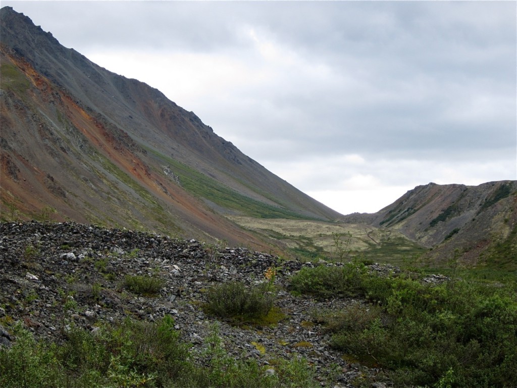
This photo shows the social trail route per the guidebook that leads back to the low bench and then climbs the steep scree to the ridge.
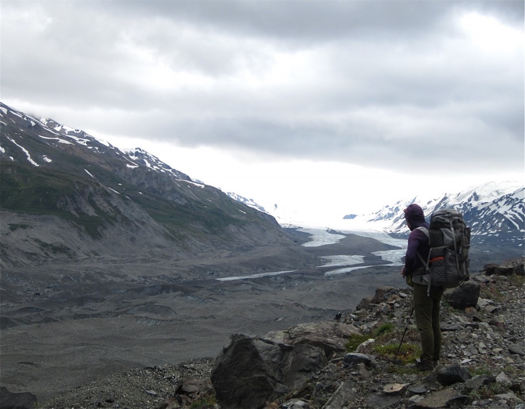
The jeep trail extends quite some distance along the moraine of the Canwell Glacier. Eventually it ends and you can cross the glacier to the Canwell Hut built by the Alaska Alpine Club in the 70’s out of Fairbanks. The area is popular with Fairbanks backcountry skiers and has been pretty much been pioneered with some incredible skins and first descents over the years. (Soon to be featured with Jeremy Jones’s visit last spring for his latest movie.) The hut is barely visible across the glacier on a low bench in the far distance.
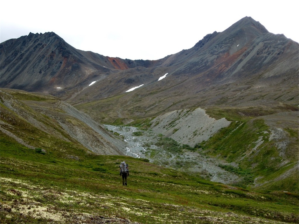
We followed the jeep trail to a high point just above brush line and began hiking south up to a vast hanging valley and with black peaks laced with yellows, browns and greens getting brighter as fall begins. Eventually it flattened out and we could see our intended route striking up toward the colorful ridge.
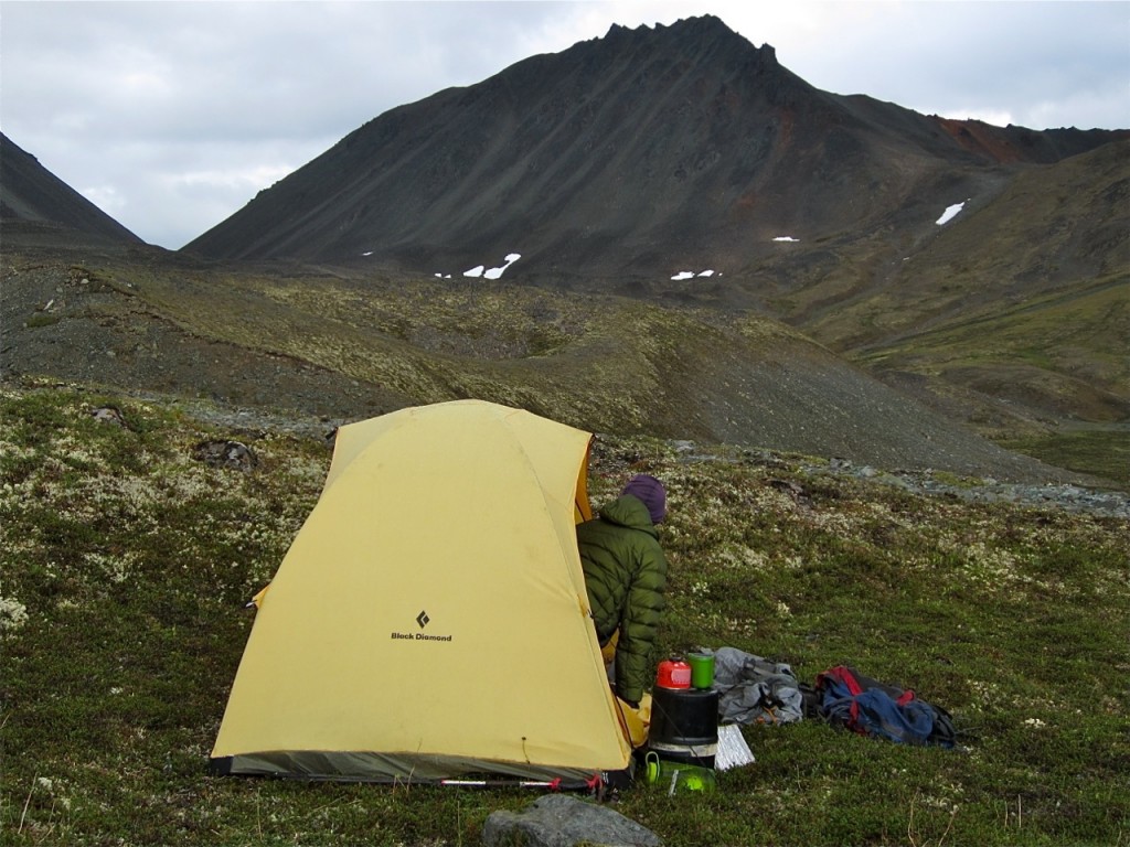
The weather was not perfect as we encountered driving sleet and rain at one point and had to hunker behind packs and wait it out. Winds never abated during our time spent in the area. Water was an issue as the only stream flowing was silty. We traveled up the valley and eventually stumbled upon a 20′ feeder spring that saved the day and trip. Setting up camp on soft tundra I kept a close eye on the weather as we experienced occasional rain squalls and south winds to 40mph.
The next morning the wind still blew but we had a break from rain and headed out and up. Heavy overcast dominated by textured, dark, and fast moving cumulus clouds blocked our views of the higher peaks in the area with classic names such as White Princess, Snow White, and Old Snowy, reflecting designations by the early mountaineers and miners of the area. To the west were a cluster of 12,000′ peaks including Mount Moffit , Shandt and nearby McGinnis Peak. ( The area has some Valdez alpine history as Brian Teale and Chuck Comstock skied up the Black Rapids and were turned back by an avalanche in the 80’s on a big wall of a big peak. Teale then skied out to the north down MGinnis Creek and circled back to the highway in what must have been a great breathtaking tour. That was one of two Teale visits to the range.) That view was blocked by low hanging curtains of stratiform rains drying out just before touching the ground in distant low valleys to the north.

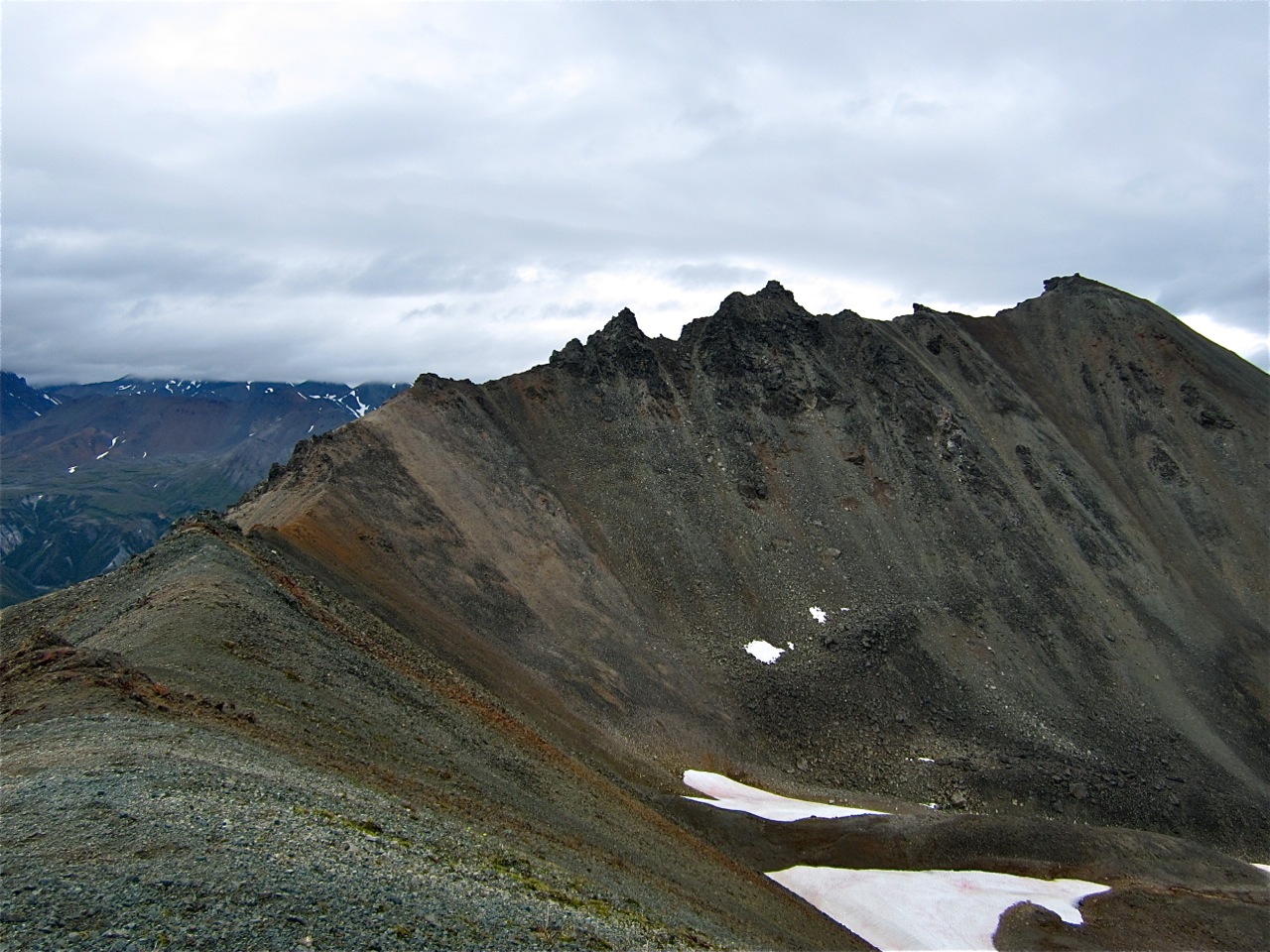
We entered the small theater and selected the least steep of many scree slopes and gave it a shot. We arrived on the ridge crest and were greeted by the deep colored landscape of Alaska at our feet. While the winds howled I explored along the ridge a bit paranoid about the weather so we didn’t spend much time expiring the ridge crest possibilities. We were happy and lucky to have made it that far.
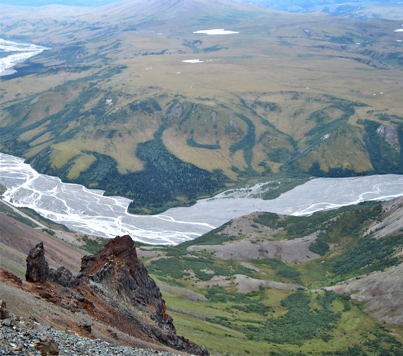
Looking down into Phelan Creek.
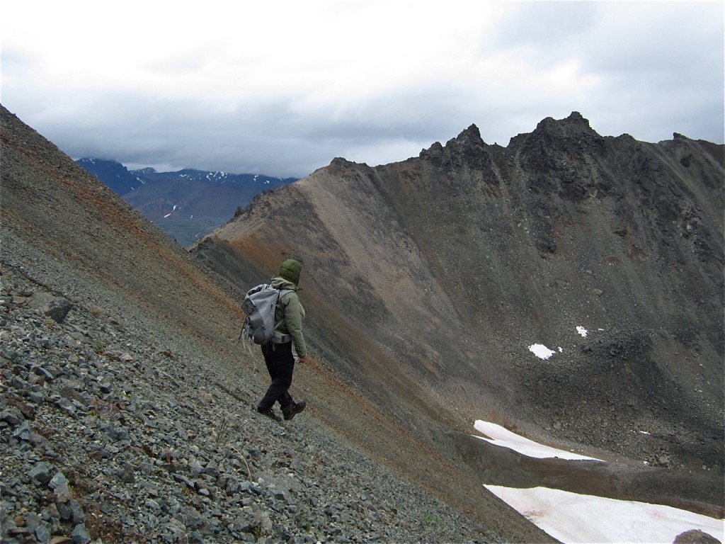
 If you’ve never “plunge-stepped” or galloped down a thousand feet of steep, soft scree you should. The Alaska Range is full of first plunge possibilities.
Just as we returned to camp, an intense rain squall had us zipping up the tent tight and waiting and hour so for the next weather break. Emerging from the tent I took note of a high peak that was splattered in wet snow to the south. It took little time to exit and return to the trailhead. We encountered a couple mountain bikers from Fairbanks who were riding the jeep trail as far as possible. One could easily mountain bike much deeper and camp at or near the hut in a matter of hours. The glacier crossing to get to the hut looks pretty tame and is done often.

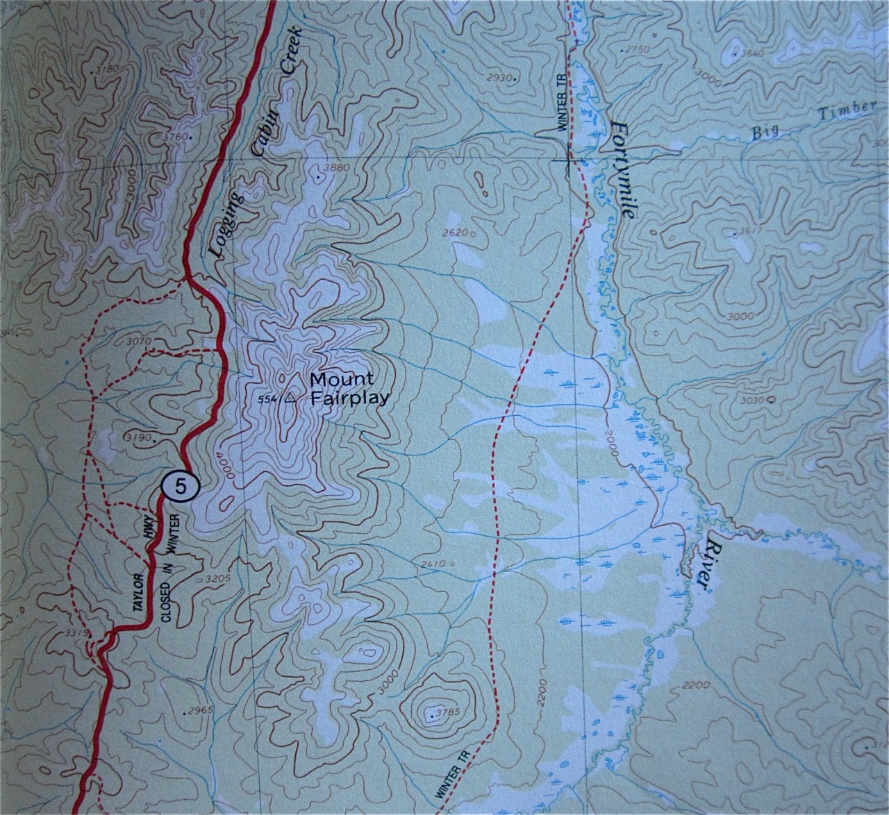
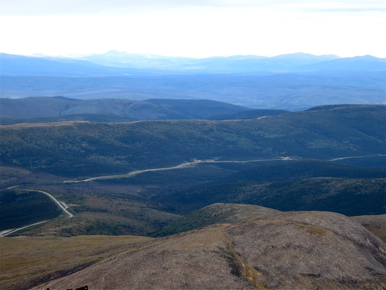
With our Alaska Range trip cut short by Red Flag Warnings issued by the NWS for the AK Range, we agreed to head to Mount Fairplay along the Taylor Highway just north of Tok. The peak is in isolation in the Forty Mile area and would certainly allow for unparalleled views of interior Alaska. It had my interest because last summer I drove right past it on a solo trip to Walcutt Mountain near Eagle at American Pass. We set up camp in a wayside at the trailhead as listed in the guide.
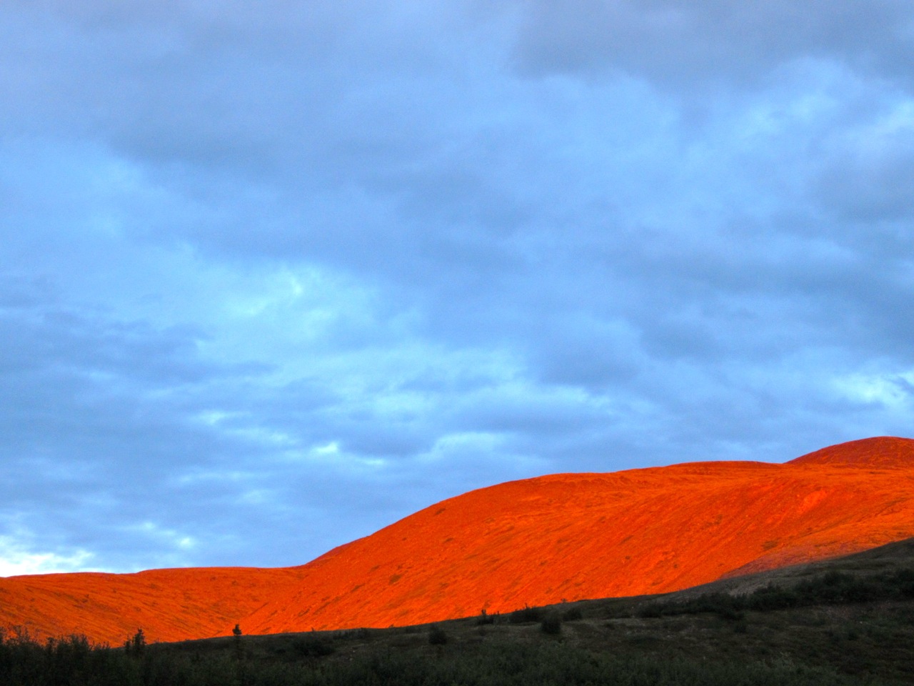
 During the night the winds came up again and we ended up lashing our larger roadside tent to our car and a stout but twisted willow. I thought for sure the tent was going to break loose, but the quick knot work survived as did the tent. As the winds howled, a break in the sky at sunset gave us nature’s glowing approval of our camp and next day’s objective.
In the morning we stepped right into spongy moss that bogged us down as we constantly sank to our ankles over a long rise up to the summit features. The low bush blueberries abounded in dotted densities and juicy freshness I have rarely encountered and we would need to stop sometime and harvest a bucket for now and leave some for winter.
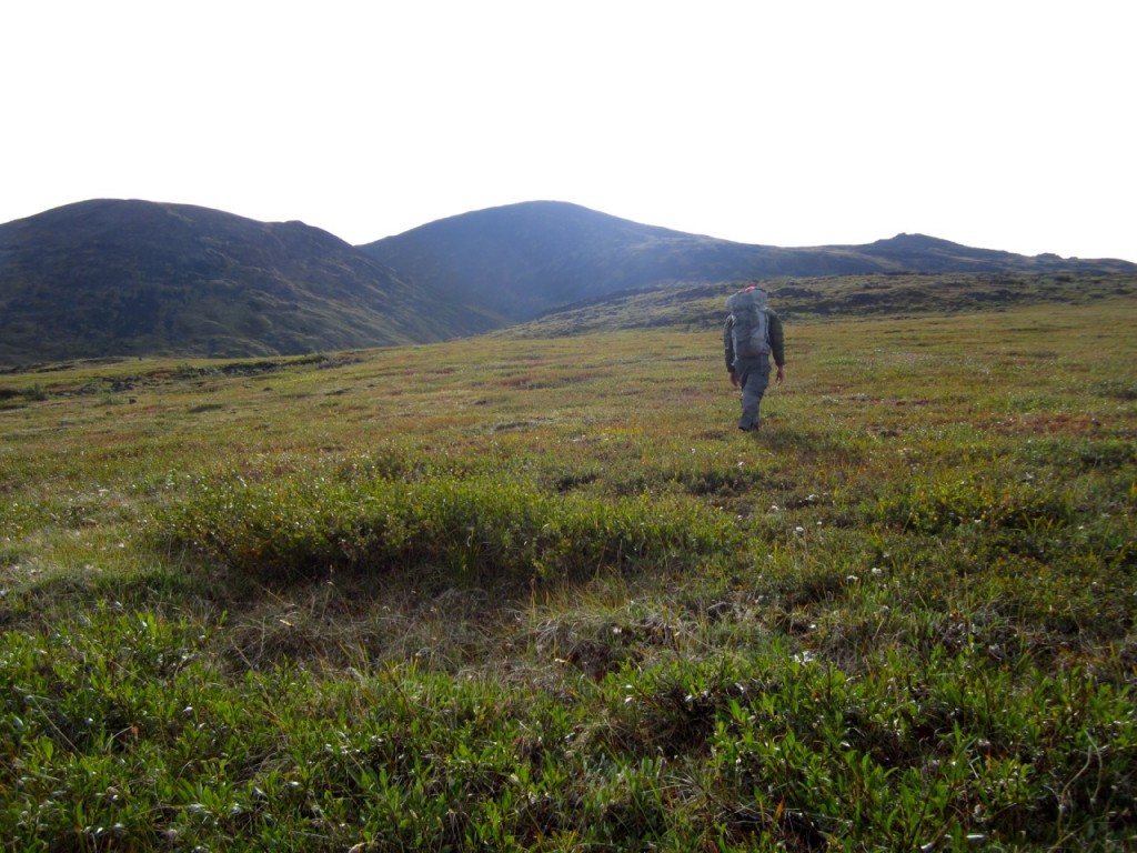
When able, we escaped the tundra trouble by poaching on a few rock piles. Eventually we got to steeper terrain and talus slopes of various sizes angles. It’s a slow scramble but eventually you reach the top and spy deep into Canada and ponder Alaska in the other direction.

We returned to Valdez the next day after visiting Chicken and the border area along the Top of the World Highway, which had just been paved to the border at the Eagle Road. Heading back to Valdez we didn’t forget the berries.
by Matt Kinney
August 19, 2014