Valdez Snow Forecast 2016/17
I hit the nail on the head last season so I might as well try again, but I’m hoping I’m wrong. With the last three winters producing unusually low snow totals at sea level around Valdez, that is enough recent anomalies to create a pattern.
But before I dabble on here’s a picture of Shoup Glacier in 1981. That is the “Blue Boat” which was captained by Pat Levy (first soloist Meteorite) and current owner of Fairbanks Distilling Company. We grounded the boat for the day to explore the Bay and prospecting in Uno Creek. For those more recent to the area, notice any changes?
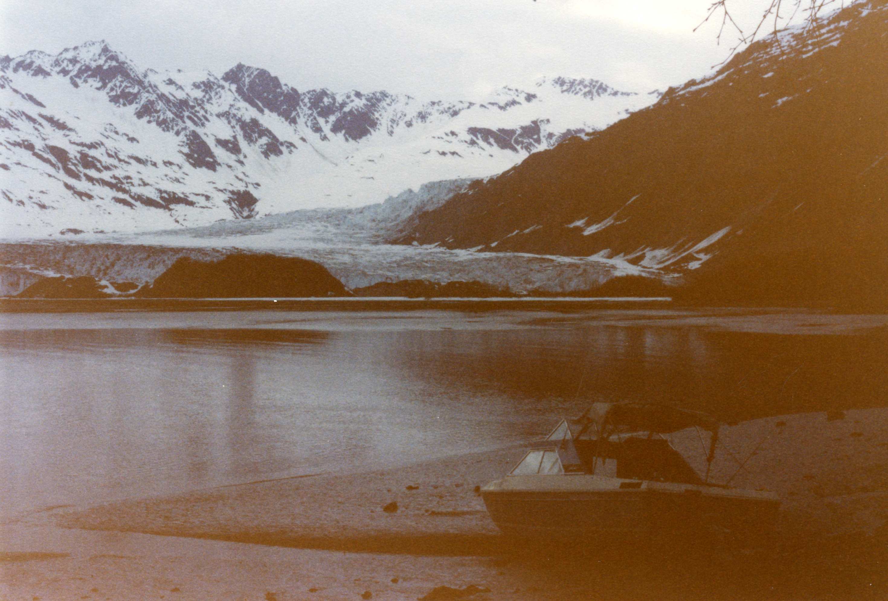
Shoup Bay 1981 (Kinney Files)
Once again we are entering winter with scant snow as of Oct 15. That date or earlier has been good for my first ski of the season in all but a handful of years over the past thirty-eight. I could either ski from the road or hike a bit to good snow but typically not good for bases!
Another thing important to note is the lack of a wind events in Valdez the past two winters. Last year, Thompson Pass had very little wind and thus the snowpack surface remained un-eroded between storms setting up a very deep snowpack above 3000′ starting with the first storm. Upper elevation snowfall and snowpack depths have remained above or at normal while lower elevations have trended to record low snow totals.
Oct 7, 2014
Also, part of the dynamics the past three years is a persistent ridge along the interior of the Coast Range of Canada from the Yukon south that sets up in November and remains til spring. How this steers our local weather is worth discussion on another level beyond my pay grade as a forecaster, but it’s notable.
For this season I don’t see much change and October models indicate little chance of measurable precip through the end of the month. So we will have no base once a Chugach quality storm does arrive, which means we have to wait for a second storm or a 24″ base to ski around safely. Snow piles up more quickly falling on snow than ground.
As far as avalanche projections, rain on snow events are more likely which is the most scary of stability scenarios. But lower elevation will see decreased concern with a low snowpack depth.
Pray for this.
With seawater temps well above average in the Gulf Alaska, we can expect the thermal “blob” to have the most effect at sea level where more rain than snow will be the pattern when storms move through. Upper elevations should see all snow and I expect a similar winter to the last three with copious snow where it counts. But the climate pattern indicates little snow after March 31 with a rapidly encroaching spring.

Ski-to-the sea a thing of the past?
If you want to geek out with numbers go to Valdez Climate History and it will show you historical data to the early century. If you look in the URL you will see the month. This can be changed to any month for Valdez. You can see the trends and rainfall amounts, snow totals,etc.
By the way, Valdez’s permanent snowfall is one month away from permanent snowfall on the top of Sugarloaf, or so goes the local rule. Dusting that melt don’t count as termination snow.