Soda Lake – Nabesna Road
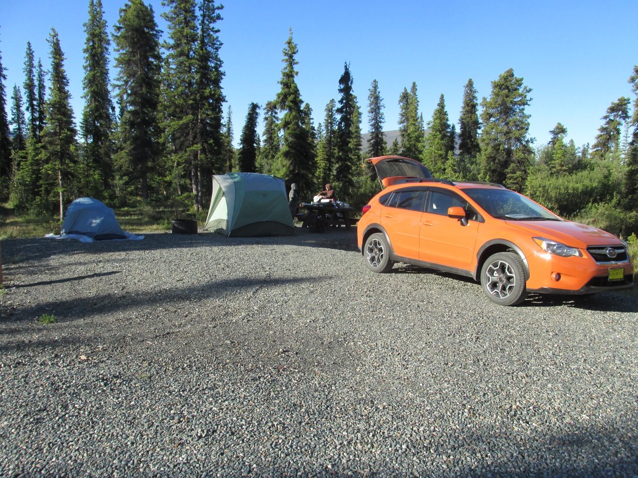
Threw the packs in the car for the 4th Weekend and headed north about 4 hours on Thursday night for the Lost Lake Trailhead on the Nabesna Road that leads into the north side of Wrangell/St.Elias National Park. It’s a spectacular area of mostly 6-7000′ peaks and vast landscapes made of ancient volcanic activity, which hides many unique geologic features deep in the Park.
Here’s a 5 minute vid of the trip:
[vimeo]https://vimeo.com/100325497[/vimeo]
We have packed extensively over the years in the Noyes Mountain mainly in the high alpine areas and some peak bagging. But this trip would take us along the base of the range in brush line along a newly constructed ORV trail, at least most of the way.
They have some hardened off tent sites along the road. After a nice sleep we woke and began packing for an 8am departure and then drove a few miles to the Lost Creek Trailhead.
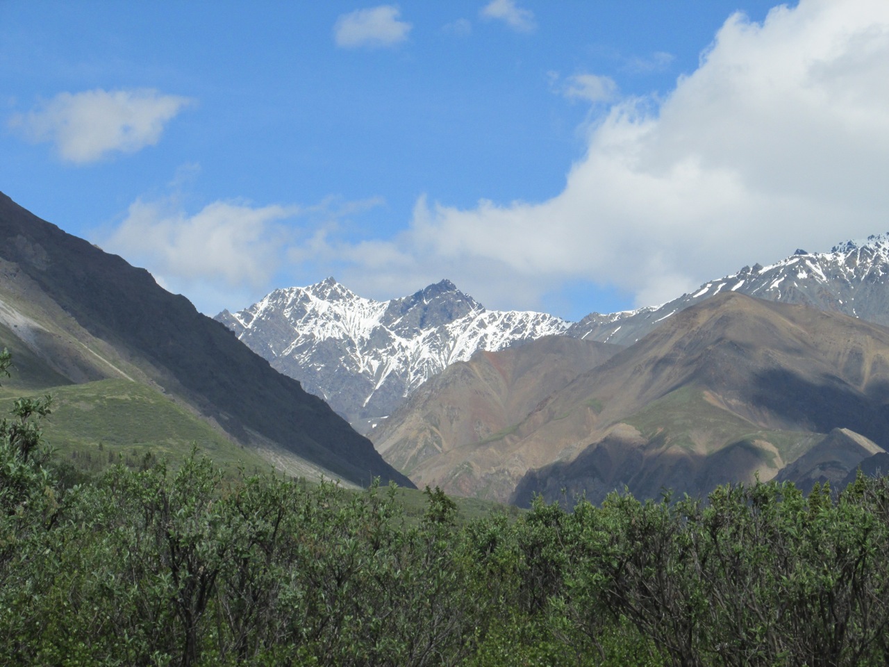
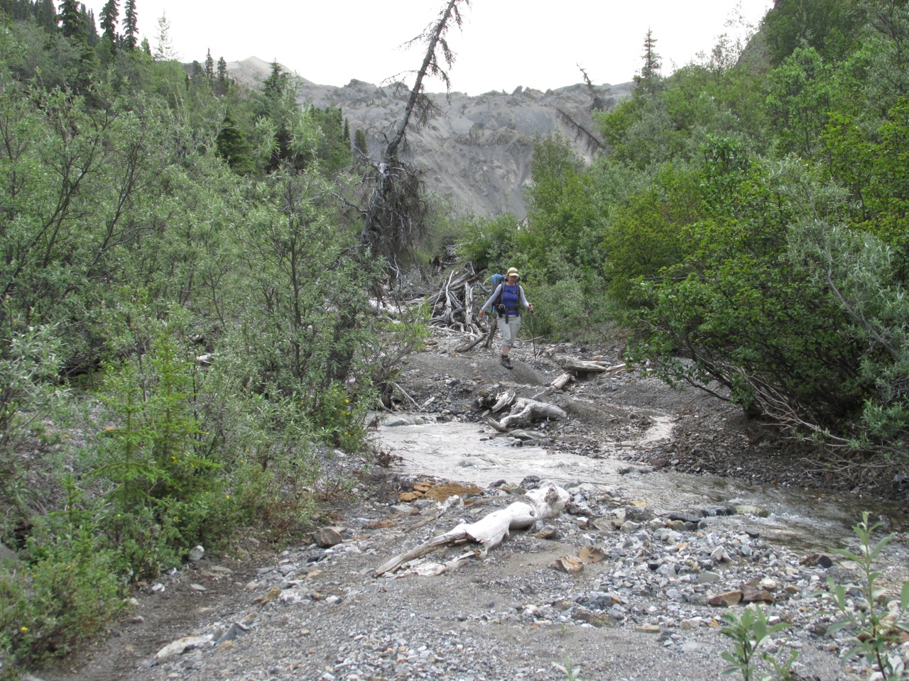
One pretty much wanders up the creek bed with a few crossings. In the distant is the pass we did two years ago near Mt. Noyes and then down Trail Creek for a few days.
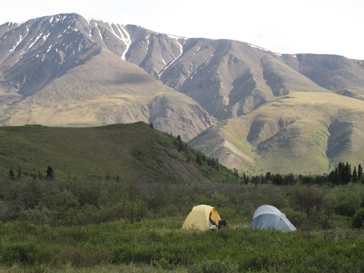
Finding a camping place the first night was not easy as anything not in a river bed was in a wet forest or open areas matted in tussocks. Here we got lucky and found a patch of gravel on a high spot just off the ORV trail.
On the second day we outdid the motor folks and entered better wilderness.
Tabitha heads up the narrowing canyon that passes a salt lick popular with Dall Sheep, but we saw no sheep this trip, some bear signs and one section of trail peppered with wolf scat for about a mile. Oh..and Bonnie stepped out of her tent for an evening walk in the fog and rousted a moose.
At this point on the route we were really confused. There was no horse trail and I had a poor park topo.
Not understanding the geological significance of the area, we knew the lake was near. A trail description mentioned a possible scramble up steep scree for a 100 feet, so we labored up and over this feature. It was actually the earthen dam that created Soda Lake.
We weren’t lost anymore.
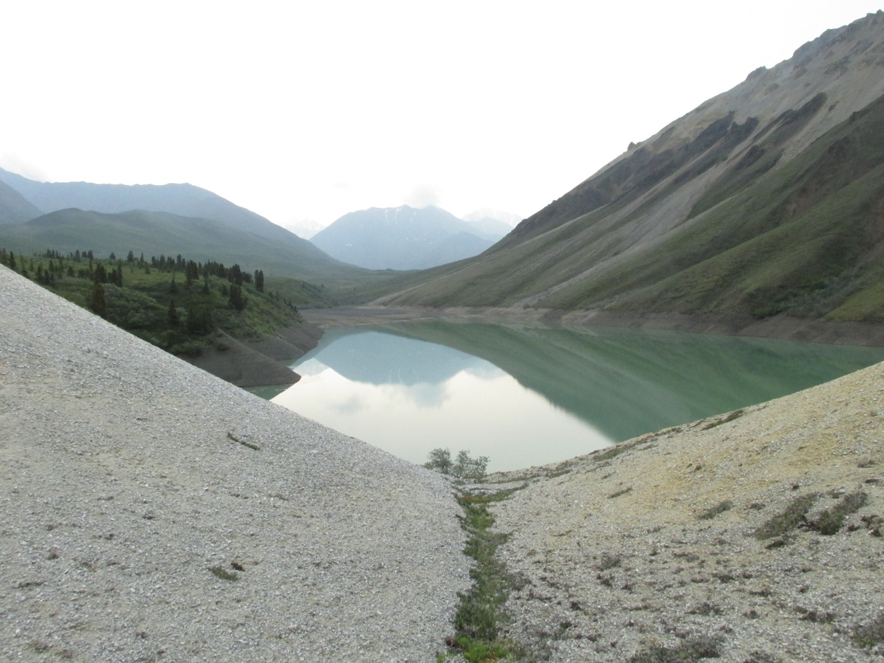
Classic Alaska tent site. In the background one can see the large two-toned scree slope that resulted when that entire side of the mountain slid down and across the creek with massive boulders and sediment created this tiny wonder in our nation’s largest national park.
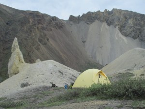
Another angle.

The following day we hiked 1/2 way out and then scrambled to set up camp as thunder roared to the south. We spent most the night under torrential rains, thunder and lightening. Flash flood situation. This meant the river would be impossible to walk down for the final 4 miles as there is no trail. We would have to bushwhack along the riverside poaching on game trails through Class III brush. So we packed and set off to the unknown and no rain back down the trail.

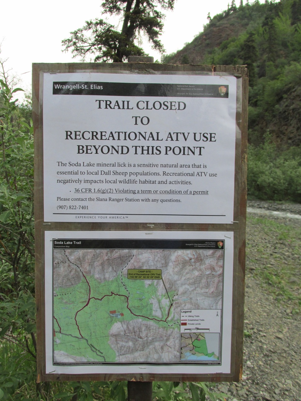
There is a legitimate attempt to prevent ATV damage. Without this effort by the Park, much of this trail would not be useable. This stuff was along one section of the new trail and seems to be working after two years.

As we got to the last mile, the river was out of its banks in the forest and running wild. We had to veer more away from the route. Finally we seemed kinda lost again and at the urging of my partners, I pulled the compass and confirmed my eternal direction finder that this was the right bushwhack. We sat in a tiny forest opening dense with mosquitoes and ate some food for 10 minutes and then loaded up our packs and amazingly, within 50 yards, we stepped onto the road.
Our adventure was not over. As we hiked back to the trailhead we had to wade two overflow streams on the road. Finally, at the trailhead parking area, I walked over to the main channel between us and civilization. The road was being washed out. This is what they warn you about the Nabesna Road over and over. I set up a small three stone cairn at the water’s edge and within an hour it was up to the first rock. We set up our camp and had dinner. The ladies went for a walk and quickly returned and pointed to water now flowing into our campsite!. So we packed everything in the car, and headed deeper into the park, driving across some overflows and eventually to a campsite at Jack Creek.
We waited overnight for the streams to drop and they did and the car that could did get us out and back to Valdez last night.

Good trip and hard. Carrying packs with 5 days food, bear canisters, etc, over 25 miles is a lot of work but alway worth the price. It is not something you practice in the evening like cycling of even skiing. This was the last trail on the Nabesna Road we had not done so that was gratifying after two decades exploring this gem few people visit.