
HIGH Avalanche Warning – Dec 29, 2014 1600AKT
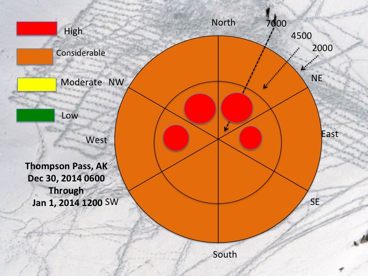
A HIGH avalanche warning is warranted from Dec 30 0600 through Jan 1 1200. At this time a slow moving system is moving into Valdez and modeled to bring 1.6″ WE at elevations above 2000′ where the persistent weak layer is present. With winds predominantly southerly, expect highest risk on north aspects and cross-loading on west and east aspects. There is also a lot existing dry snow at the surface to transport along with storm snow to trigger things early in this storm cycle. Peak of event and related risk estimated at midnight on Dec 30. The storm will also bring “upside” down” snow as it rapidly warms with moderate snowfall to 24″ above 3000′. Large pockets of shedding are likely from Thompson Pass north, much like the visible avalanches during the past month. Backcountry travel in or near steep avalanche terrain is not recommended during this warning period.
High pressure builds quickly late New Years Day followed by clear, cold and windy through the weekend.
Road Runners should be happy as this storm should open it up for 2015 with some significant snow.