Avalanche Warning Extended Through Friday
HIGH AVALANCHE WARNING CONTINUES
Issued 11-25-15/1500AKT
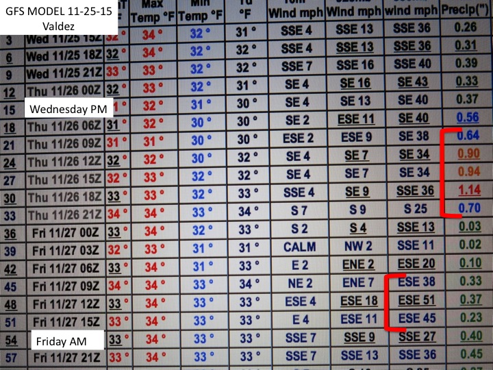
Heavy precipitation will continue overnight into Friday morning across all elevation of the Valdez Chugach. Upper mountain area will continue to receive heavy snow. Today’s drive through of the Pass had poor visibility in Thompson Pass today with a foot of new snow blowing around.
Some things to ponder is the DOT atmospheric meteogram. Temperature have varied little during this event, staying in the 25-28F setting up a cohesive snow layer at the surface. Valdez has also remained unusually colder than the rest of SC AK.
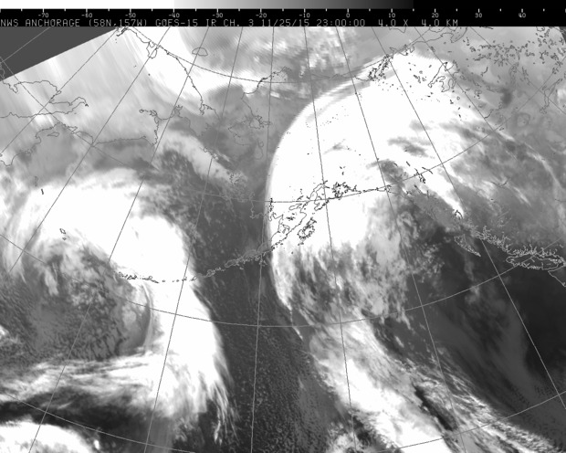
As indicated in the satellite grap today, another more potent low will spin into Valdez as the other moves away, continuing this sustained period of snow in the Chugach and a mix at sea level. All this weather is a red flag and BC travel should be restricted to mellow terrain under 32 degrees and away from major run outs in Thompson Pass.