27-Mile Glacier – Carbon Indicator
As we wait for a new ski season we might want to look at the past as to how we move forward. I guess if you’ve been around a couple years you might have barely noticed the changes in the 27-Mile Icefall on Thompson Pass above Loveland Basin. Fortunately I’ve been pretty aggressive with my cameras since I moved here and was able to capture some images that shed some light on the negative impacts of our use of fossil fuels, specifically by comparing our local glaciers. This is one of a few glaciers I’ve tracked and hope to present some others later.
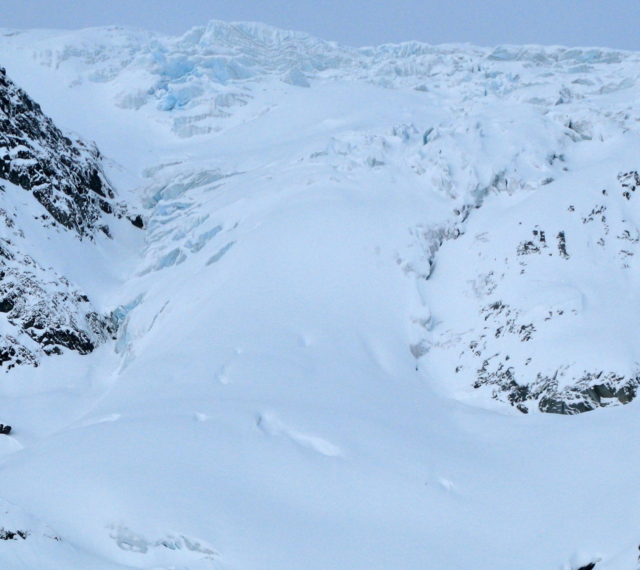
The 27-Mile Ice Fall in 1980 stretched completely across Loveland Valley when I first skied from the the shoulder of the peak in 1981 with John Weiland and Scott Ethrington. For perspective(or irony), the “pick-up zone” commonly used by the gas guzzling sledders of today was under ice. A sledder back then would have had to cross the glacier to get to upper Loveland. To avoid the crevasses around the terminus, skinners stuck to the ridge to access the upper Basin.
This glacier is melting faster each year. The snows come later and break-up earlier, exposing the ice-fall to increasingly heavy rain events and summer days with record breaking heat.
In the early 80s’, “chemical” cameras (Yashika FX2) only got you a limited amount of shots of quality. You waited nearly a month after sending and then waiting for your 24-36 prints to arrive in a paper bag at the post office complete with negatives. A few were always a disappointment. It was frustrating compared to today. “Social media” was defined when you gathered enough decent shots and then gathered for a slide show at a home, library or the museum. I recall a slide show at Tsaina Lodge by Weiland. I have hundreds of pictures of Thompson Pass in my collections from the 80’s and 90’s. A few I’ve scanned, while others are simply a picture of a photo taken with a modern digi-cam. Below are a some of the pictures showing the retreat of one of the most iconic geological features of the Richardson Highway.
The first picture was taken during the first or second WESC event while skiing with Australian contestant Jeff Small to Loveland Peak and then hitting the lowers of the glacier on the exit. At that time I rarely saw anyone else in the area. Today the zone is quickly becoming another “mini-tailgate”. But the ski tour up and through the icefall and onto Sapphire will continue to provide a clean and technical approach for those who want to seriously test ski skills.
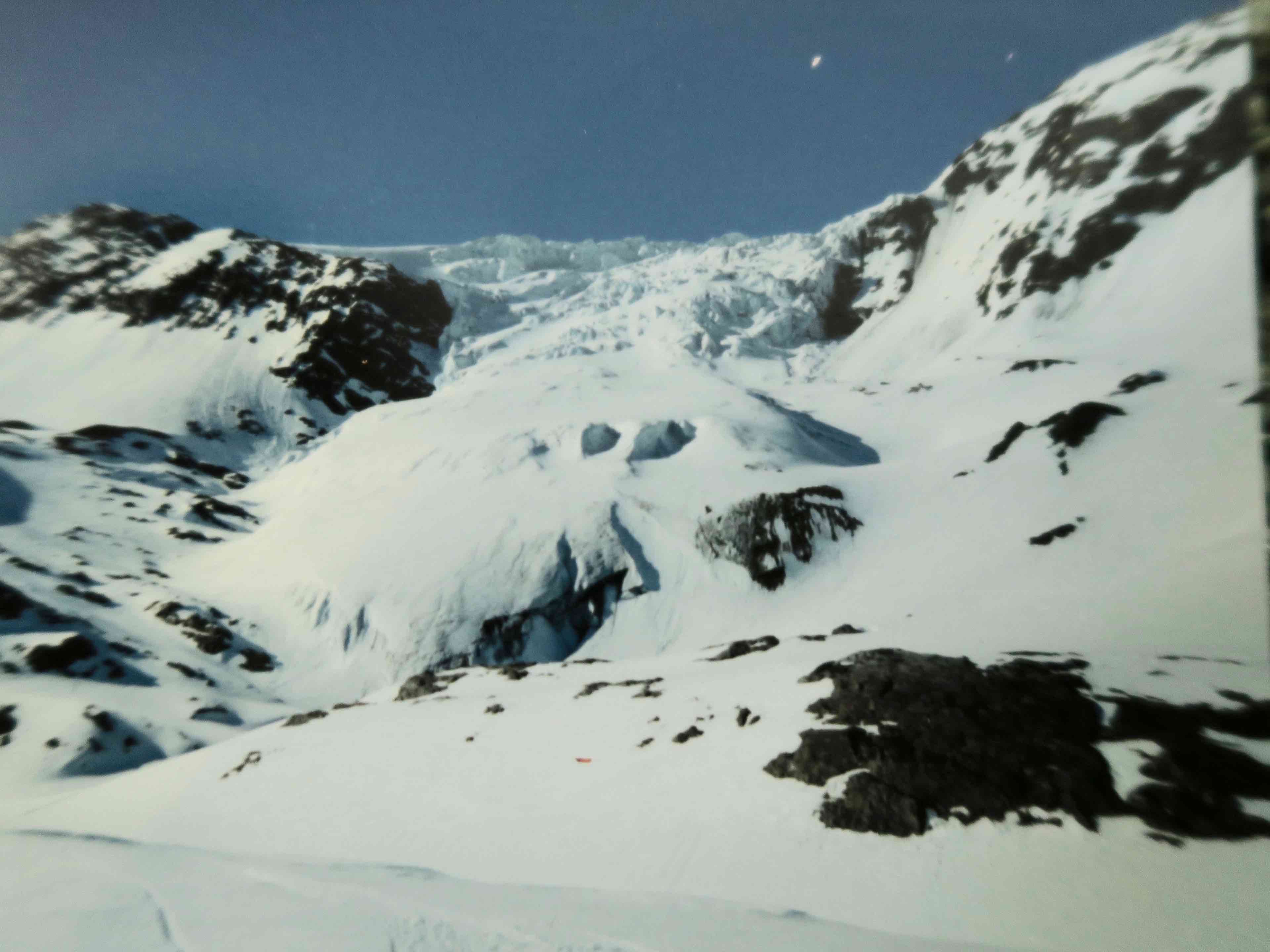
1992
In time, snowboarders figured it out kinda. Here a couple locals I drug off the road run to break a sweat in the mid 90’s. Tony Mann and Done Mels as I recall in the below picture with huge boards. I was solo in the basin at some point during the heyday of WESC and witnessed Doug Coombs and a couple skiers ski from Sapphire and down through the Icefall favoring lookers left against the rock band. I finally skied the entire icefall in the late 90’s on a solo mission to Sapphire.
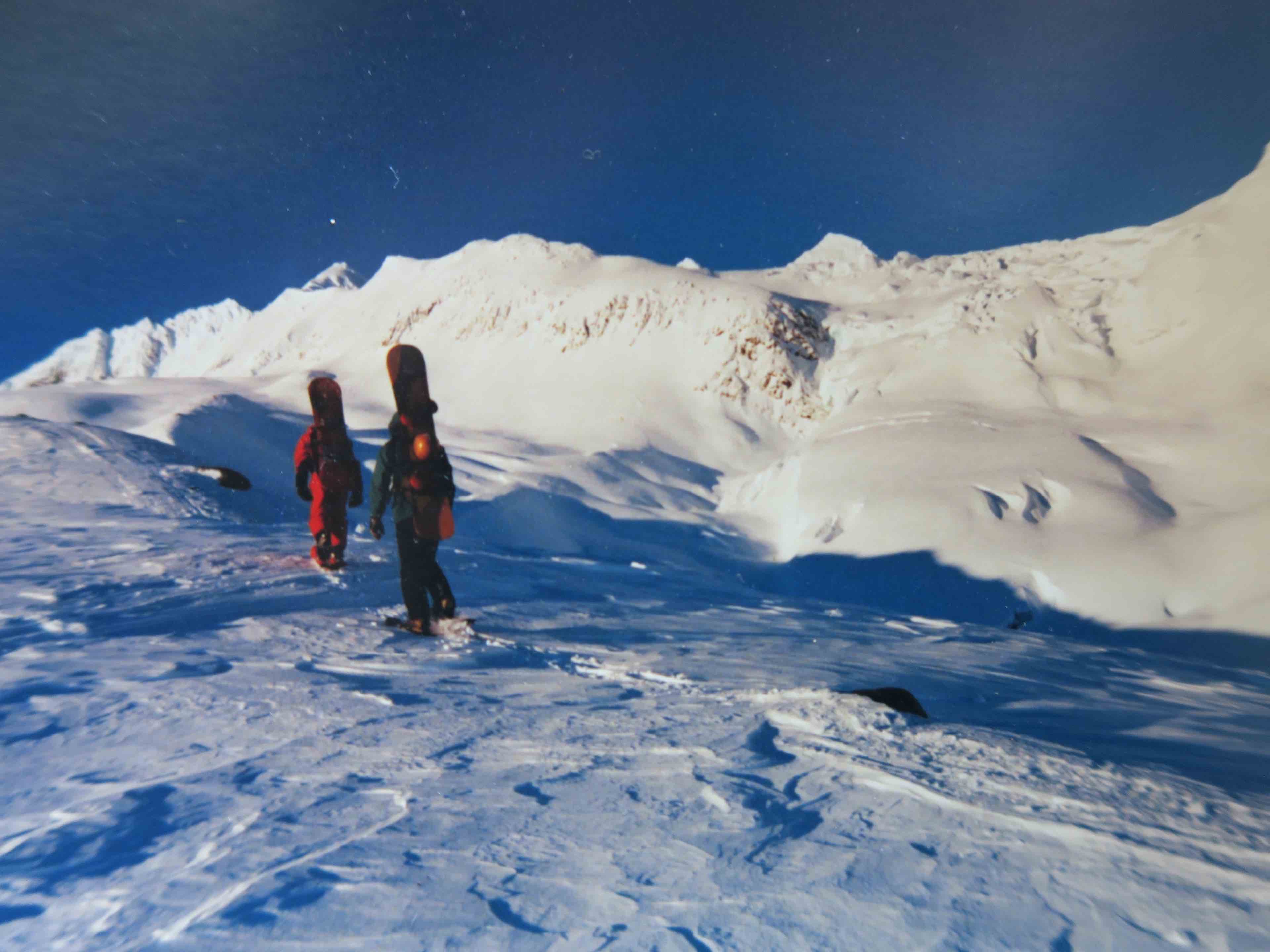
1996
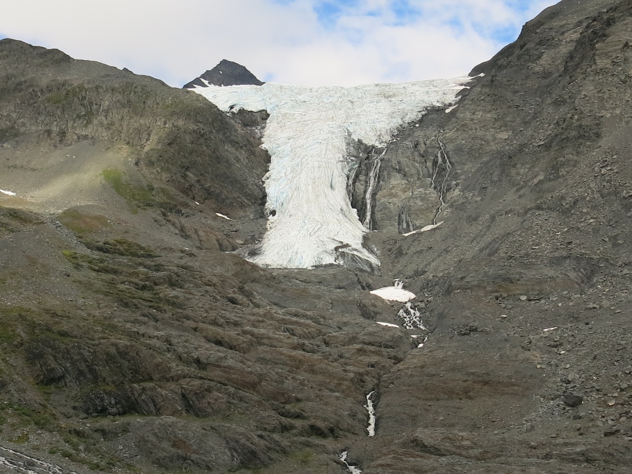
By 2000 the first in a series of canyons became visible at the base along with more glacier free terrain to ski. My favorite line coming off Loveland was to traverse across the DOT Glacier and head to the Ice-fall and get enough speed to hop up on the glacier as high as possible, ski the snout, and continue down to the trailhead.
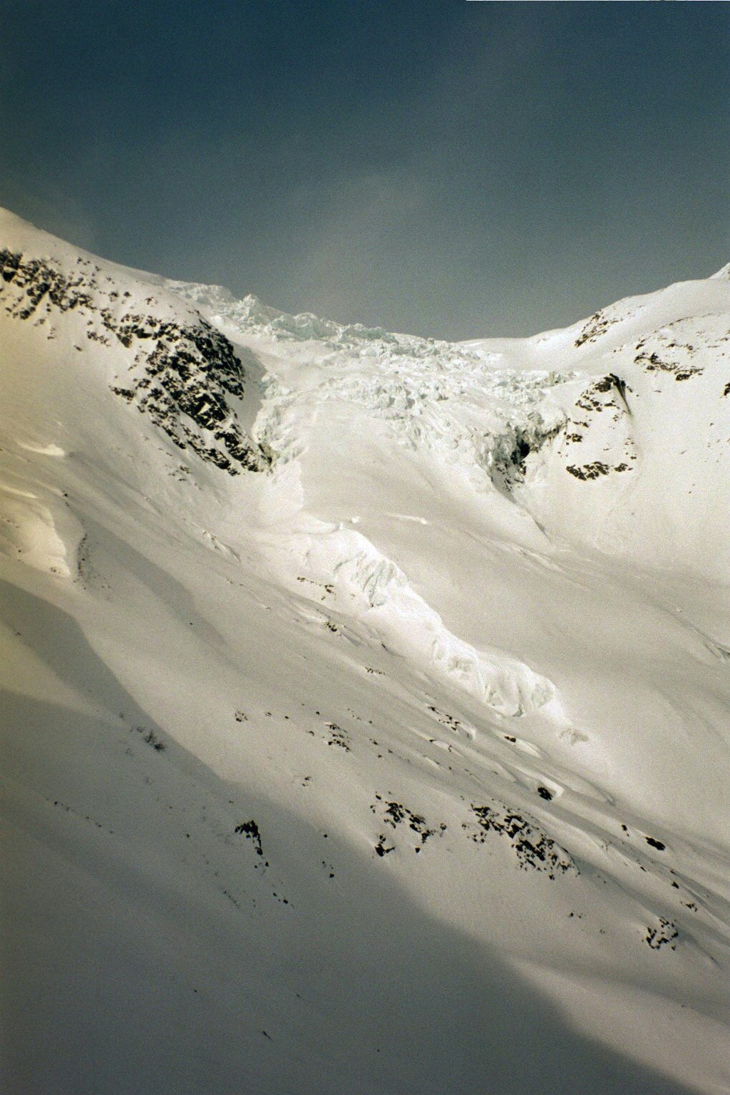
2004
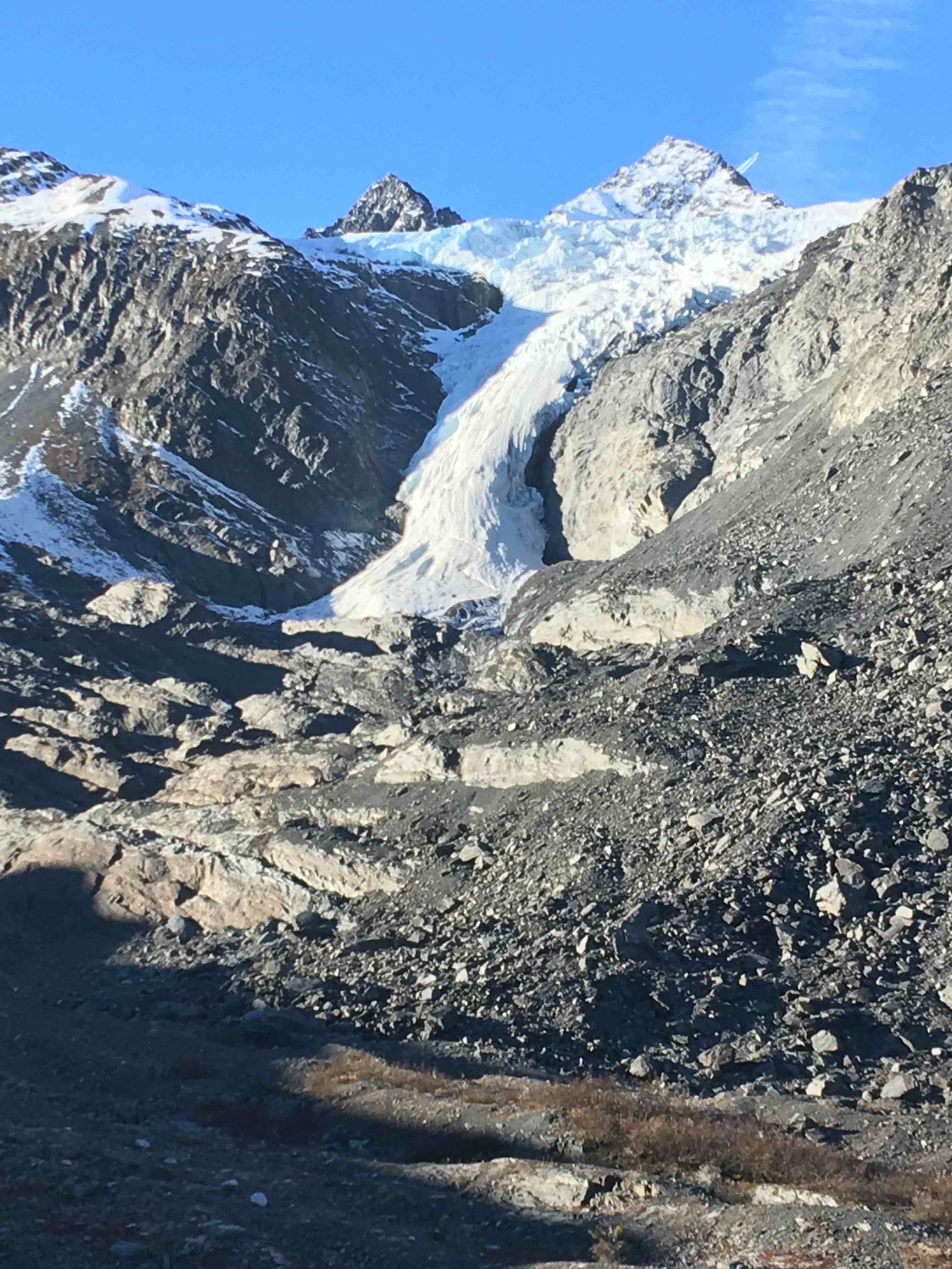
By 2010, the Icefall had melted enough to dramatically morph, sag, and steepen. The middle section began increasing it’s slope angle into an avalanche problem. Numerous times I have kick-turned up the glacier and then booted through the Icefall as outlined in my guidebook. The middle section once measured about 25 degrees, last winter it was in excess of 35 degrees at it’s crux and is becoming too hazardous to ascend at times due to avalanche concerns. In 2012, a slab avalanche occurred right in the middle, the first time I’ve documented an avalanche on the Icefall
2010
Over the past decade the melt has intensified to where the glacier is just a hint of it’s former self. Below the icefall, one can easily see the newly scoured benches and small slot canyons left behind since the 1980’s. When I arrived in Valdez, the glacier would have reached to my feet as I took this picture.
2015
It’s still a wonder to look at, clinging like glue to steep rock faces and oozing out of the Chugach. I have observed that the most erosive effect on this and other glaciers in the Chugach is “rain on ice” as the snowpack on the ice is entirely melting, versus being retained for the next winter. Over the past few years we have had some heavy rain events in September or October that have wreaked havoc and sped up the melt. New earth is exposed and fabulous glacier skiing is lost.
2017
Ski as you may, but mechanized skier should realize that they are part of the problem, not the solution. Minimize your sled use by touring more or only for efforts of great distance from day tours. It’s not that hard and it’s never too far. Mechanized skiing is one of the most carbon intense recreational activities on the planet and as skiers we need to think about that as the glaciers melt, the oceans rise, and our children grow.