Avalanche Statement – Considerable Coming
Short and long-term models and forecast discussions indicate rising temps and precipitation for the weekend. With a soft, unconsolidated, deep 300cm+ snowpack above 2700′ in Thompson Pass the avalanche hazard for most aspects and elevation will increase to CONSIDERABLE beginning Friday morning. Sloughing, point releases and “channeling” may be large as there is really no bed or weak layers, just ground. Valdez has not had a real avalanche cycle this season. With brisk winds associated with moist southerly flow sustained through Sunday, heavy snow in some areas can be expected. Rain on snow possible above 2500′. It also bears mentioning again that the temperature on Thompson Pass for the past few months has hovered within a few degrees of 25F during all the accumulated snowfall, creating an unusual snowpack of settled and broken stellar dendrites. Moderate rates of wet snow on top of the current snow pack is a red flag. Slower rates will allow the snowpack time to adjust.
Added caution about local glide cracks. Observations indicate some activity in unusual areas and where I’ve not seen them before. This is to be expected considering the structure of the snowpack. These along with climax slides are more likely nearer Valdez on mainly south aspects.
With coastal cloud dominating, north of Crudbuster will see some clearing as clouds get filtered. Good areas to explore. There is a topo of the area on my GUIDE BOOK page.
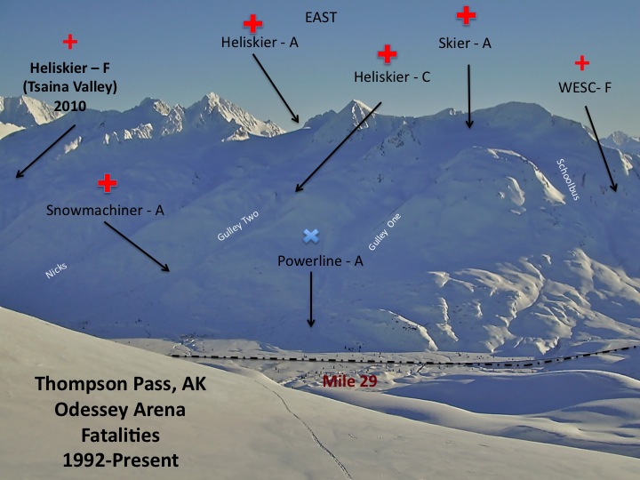
I created this a number of years ago. Fortunately no updates have been needed. Be careful out there poking around in the coming few days.
F-Fall, A-Avalanche, C-Crevasse

by Matt Kinney
